domingo, 17 de setembro de 2023

Pyrénées - Mont Perdu | France


This outstanding mountain landscape, which spans the contemporary national borders of France and Spain, is centred around the peak of Mount Perdu, a calcareous massif that rises to 3,352 m. The site, with a total area of 30,639 ha, includes two of Europe's largest and deepest canyons on the Spanish side and three major cirque walls on the more abrupt northern slopes with France, classic presentations of these geological landforms. The site is also a pastoral landscape reflecting an agricultural way of life that was once widespread in the upland regions of Europe but now survives only in this part of the Pyrénées. Thus it provides exceptional insights into past European society through its landscape of villages, farms, fields, upland pastures and mountain roads.

Year of Inscription: 1997


domingo, 10 de setembro de 2023

Historic Centre of Oporto, Luiz I Bridge and Monastery of Serra do Pilar | Portugal

* sent from the Czech Republic


The city of Oporto, built along the hillsides overlooking the mouth of the Douro river, is an outstanding urban landscape with a 2,000-year history. Its continuous growth, linked to the sea (the Romans gave it the name Portus, or port), can be seen in the many and varied monuments, from the cathedral with its Romanesque choir, to the neoclassical Stock Exchange and the typically Portuguese Manueline-style Church of Santa Clara.

Year of Inscription: 1996

High Coast / Kvarken Archipelago | Finland


The Kvarken Archipelago (Finland) and the High Coast (Sweden) are situated in the Gulf of Bothnia, a northern extension of the Baltic Sea. The 5,600 islands of the Kvarken Archipelago feature unusual ridged washboard moraines, ‘De Geer moraines’, formed by the melting of the continental ice sheet, 10,000 to 24,000 years ago. The Archipelago is continuously rising from the sea in a process of rapid glacio-isostatic uplift, whereby the land, previously weighed down under the weight of a glacier, lifts at rates that are among the highest in the world. As a consequence islands appear and unite, peninsulas expand, and lakes evolve from bays and develop into marshes and peat fens. The High Coast has also been largely shaped by the combined processes of glaciation, glacial retreat and the emergence of new land from the sea. Since the last retreat of the ice from the High Coast 9,600 years ago, the uplift has been in the order of 285 m which is the highest known ''rebound''. The site affords outstanding opportunities for the understanding of the important processes that formed the glaciated and land uplift areas of the Earth''s surface.

Year of Inscription: 2000

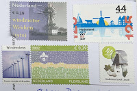
Mill Network at Kinderdijk-Elshout | Netherlands


The outstanding contribution made by the people of the Netherlands to the technology of handling water is admirably demonstrated by the installations in the Kinderdijk-Elshout area. Construction of hydraulic works for the drainage of land for agriculture and settlement began in the Middle Ages and have continued uninterruptedly to the present day. The site illustrates all the typical features associated with this technology – dykes, reservoirs, pumping stations, administrative buildings and a series of beautifully preserved windmills.

Year of Inscription: 1997

domingo, 3 de setembro de 2023

Mount Sanqingshan National Park | China


Mount Sanqingshan National Park, a 22,950 ha property located in the west of the Huyaiyu mountain range in the northeast of Jiangxi Province (in the east of central China) has been inscribed for its exceptional scenic quality, marked by the concentration of fantastically shaped pillars and peaks: 48 granite peaks and 89 granite pillars, many of which resemble human or animal silhouettes. The natural beauty of the 1,817 metre high Mount Huaiyu is further enhanced by the juxtaposition of granite features with the vegetation and particular meteorological conditions which make for an ever-changing and arresting landscape with bright halos on clouds and white rainbows. The area is subject to a combination of subtropical monsoonal and maritime influences and forms an island of temperate forest above the surrounding subtropical landscape. It also features forests and numerous waterfalls, some of them 60 metres in height, lakes and springs.

Year of Inscription: 2008

Central Zone of the Town of Angra do Heroísmo in the Azores | Portugal


Situated on one of the islands in the Azores archipelago, this was an obligatory port of call from the 15th century until the advent of the steamship in the 19th century. The 400-year-old San Sebastião and San João Baptista fortifications are unique examples of military architecture. Damaged by an earthquake in 1980, Angra is now being restored.

Year of Inscription: 1983

Vatnajökull National Park - Dynamic Nature of Fire and Ice | Iceland

* sent from Germany This iconic volcanic region covers an area of over 1,400,000 ha, nearly 14% of Iceland's territory. It numbe...